
Official Printable Leonida Full Map Pack
Rockstar's official high-resolution digital Leonida Full Map & Cover Art Poster formatted for home and wall printing.
Rockstar Media Portal ↗View the un-fogged GTA 6 full map of the State of Leonida (>2x GTA 5's size across 6 regions and Lake Leonida)—filter interactive Ammu-Nation, safehouse & cash pins, learn fast Fog of War clearing routes, or print a clean reference sheet.
Major urban gun shop with Shooting Range challenges and permanent Owned weapon locker sync.
Weapons & Locker Guide →Jason's starter coastal stilt house loaned by Brian Heder—park outside for full trunk armory access.
Trunk & Safehouse Guide →Early Chapter 1–2 hideout strip with wardrobe disguise swaps and alleyways for losing police sight.
Beginner Starter Guide →West-coast gun counter convenient for early 9mm suppressors, extended mags, and body armor.
Klose K17 & Pistols Guide →Unlocks early in Chapter 2—sell stolen un-tracked street cars here for quick, repeatable $1,000+ cash.
Early Money-Making Guide →Mariana County island hub—home to Mandy's 'Pipework' rental house and Kenton's scuba treasure reefs.
Mandy & Key Lento Guide →Meet returning GTA Online fixer Valentina ('Val') here for VIP bodyguard work with Andres de Leon.
Returning Characters Guide →Art Deco beachfront, Jack of Hearts club district, Mini Golf, and Only Raw Records nightlife hub.
Boobie Ike & Nightlife Guide →Sugar-refinery highway turf controlled by outlaw bikers—prime showcase zone for heavy .357 revolvers.
Mustang .357 Revolver Guide →Mangrove bayou hideouts holding wall safes, contraband stashes, and Double-Barreled Shotguns.
Shotguns & Airboat Guide →High-elevation hunting trails, kayak rapids, and secluded conspiracy cabins along the northern border.
Rifles & Snipers Guide →Iconic giant whale roadside attraction parodying classic Florida Keys tourist landmarks.
Easter Eggs & Cheats Guide →
Rockstar's official high-resolution digital Leonida Full Map & Cover Art Poster formatted for home and wall printing.
Rockstar Media Portal ↗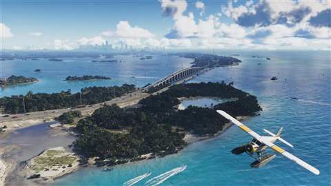
In-engine visual tour of Vice City, Leonida Keys, Grassrivers, Port Gellhorn, Ambrosia & Mount Kalaga.
Open 6 Regions Guide →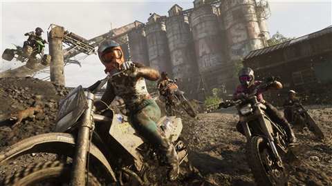
Pair our full-map pins with browser-saved checkboxes for WAiNK landmarks, Shooting Ranges, Pool & Mini Golf.
Open 100% Tracker →Rockstar's GTA 6 full map of the State of Leonida is more than twice the total landmass of GTA V's Southern San Andreas, split into roughly 65% land and 35% coastal and inland waterways. Unlike GTA V's single-city island, Leonida connects dense urban metros, secondary industrial cities, marshes, and mountains.
| Map Scale Metric | GTA 5 (Los Santos & Blaine County) | GTA 6 Full Map (State of Leonida) | Practical Gameplay Impact |
|---|---|---|---|
| Total Playable Map | Baseline 1x Island Landmass | Over 2x Total Landmass | Cross-state drives from Key Lento to Mount Kalaga feel like real road trips. |
| Main City Core | Los Santos Downtown & Hills | Vice City (~2x Los Santos City) | Packed with enterable interiors, CCTV grids, Ocean Beach & Little Cuba. |
| Greater Urban Sprawl | Limited Suburban Ring | Vice-Dale Metro (~11x Built-Up Area) | Continuous suburbs, bridges, Starfish Island, docks & international airport. |
| Secondary Towns | Small Rural Stops (Sandy Shores, Paleto) | Port Gellhorn, Ambrosia & Keys | Secondary hubs rival Los Santos's footprint with independent fences & banks. |
| Map Fog System | Fog of War on New Save | Dynamic Grey/Black Fog of War | Must physically drive, boat, or fly through each sector to uncover roads. |
| Leonida Region | Official County / Real Inspiration | Signature Terrain & Landmarks | Essential Early-Game Pins |
|---|---|---|---|
| Vice City | Vice-Dale County (Miami) | Neon Ocean Beach, Downtown towers, Starfish Island & Leaf Links | Central Ammu-Nation Range (#01), Airport (#07), Club Strip (#08) |
| Leonida Keys | Mariana County (Florida Keys) | Southern barrier island chain, coral reefs & Key Lento | Brian's Stilt Safehouse (#02), Scuba Reefs & Mandy's Rental (#06) |
| Grassrivers | Florida Everglades | Primordial mangrove swamps, airboat channels & contraband camps | Bayou Stash Camps (#10) & Bret's wildlife hunting zones |
| Port Gellhorn | Gulf Coast Industrial Hub | Gritty motels, pawn fences, commercial docks & coastal highways | Motel Hideout (#03), Coastal Ammu-Nation (#04) & Moses Fence (#05) |
| Ambrosia | Central Sugar Heartland | Allied Crystal sugar refinery, Lake Leonida shore & biker highways | Refinery Armory Turf (#09) |
| Mount Kalaga | Northern Border Wilderness | Elevated canyon ridges, whitewater kayak rivers & hunting trails | Northern Ridge Overlooks (#11) |
When you start Chapter 1, the Pause Menu hides the GTA 6 full map beneath a classic grey-and-black Fog of War overlay. Clearing every county efficiently takes about 45–60 minutes once free roam opens if you combine coastal aircraft flights, interstate highway loops, and smartphone landmark check-ins.
Tip — Print an Un-Fogged Desk Sheet: Don't want to squint through Fog of War in Chapter 1? Click
🖨 Print Full Map Sheetin the toolbar above (or pressCtrl+P/Cmd+P) to print a clean, menu-free 1-page Leonida region and armory reference sheet.
Stick to the southern Leonida Keys, Port Gellhorn, and Vice City during your opening five hours before pushing north into Grassrivers, Ambrosia, and Mount Kalaga. Following this south-to-north path matches story chapter unlocks and ensures your personal vehicle trunk armory holds heavy firepower before entering outlaw biker or predator turf:
#02), clear Key Lento jobs like Mandy's 'Pipework' mission, buy 9mm suppressors at Downtown Vice City Ammu-Nation (#01), and sell un-tracked street cars to Moses (#05) in our Early Money-Making Guide.#11). For neighborhood-by-neighborhood photo tours, open our All 6 Leonida Locations Guide.